By Paul Swenson EBS COLUMNIST
What a great beginning to our ski season. There is a deep, early snowpack blanketing our region. It got me thinking about a process that shaped our surroundings and is still active in some high mountain valleys.
Imagine that we could get enough snow this winter that it wouldn’t all melt next summer. For illustrative purposes, let a foot of unmelted snow remain on a snowfield making it through until next winter. Then another epic snowfall the next year, some of which makes it to the following winter. Year after year this happens. After a century of this cycle there is now one hundred feet of accumulated snow; after a millennium, a thousand feet. As the snow piles up it compresses into ice, and under its own weight begins to move. A glacier is born. It is really that simple.

What kind of conditions would be needed to have that much snow fall every year? The answer to that question is surprising: A warm ocean and a warm atmosphere. If one looks at the Earth’s ancient temperature record from ice core data using oxygen isotope ratios, it is apparent that before each glacial period, the average surface temperature of the Earth rises. This causes an increase in the amount of evaporation from the oceans. The additional water in the atmosphere is carried over the continents ending up as rain or snow.
So what are the signs of glaciation in the Big Sky region? Glaciologists and geomorphologists look for certain landforms created by the extreme erosional power of moving ice. Of course, it is actually not the ice that erodes the landscape, but rather the rocks incorporated into the ice that are dragged along with the underside of the glacier. Think of this analogy: Try smoothing a rough piece of wood with plain paper by rubbing the surface. It’s difficult until an abrasive is added to it, then you have sandpaper. So a glacier’s ice is like the plain paper, the incorporated rock the sand, so the glacier becomes the landscape’s sandpaper.
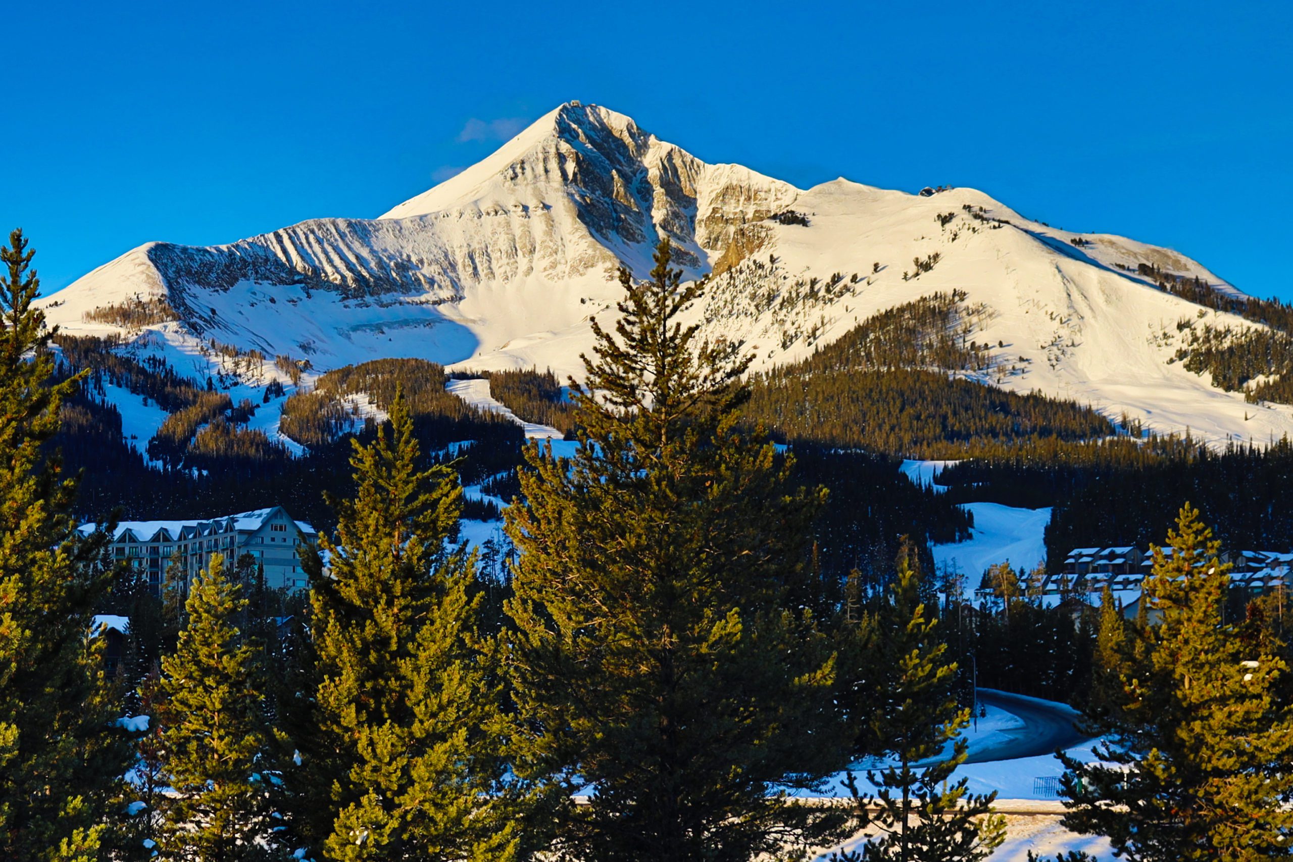
There are many landforms that indicate glacial erosion, but you only need to learn four obvious ones here: Cirque, Arête, Horn, and U-shaped valley. As the accumulated ice starts to move, it erodes a depression on a mountain side. With the feedback loop of more and more accumulation of snow and ice, this depression grows and grows becoming a large semi-circular basin or bowl, in the mountain. This landform is called a cirque, French for a circular or semi-circular amphitheater. Big Sky’s bowl is a cirque (the other definition of cirque is circus, which we can also observe in the bowl daily).

As one progresses around Lone Mountain you discover other cirques as well: Stillwater Bowl, Deepwater Bowl, and Wyoming Bowl.
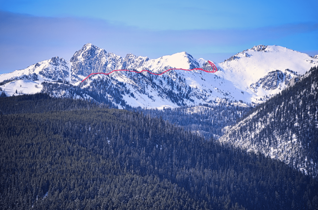
The second landform that can be identified on Lone Peak is the Arête. Arête translates as a crest or ridge and is defined to be the rocky ridge between two cirques on a mountain. So for Big Sky it is the ridge skiers hike between the A-Z chutes and the Headwaters chutes. Another good example of an arête is the ridge between Beehive Basin and Middle Basin.
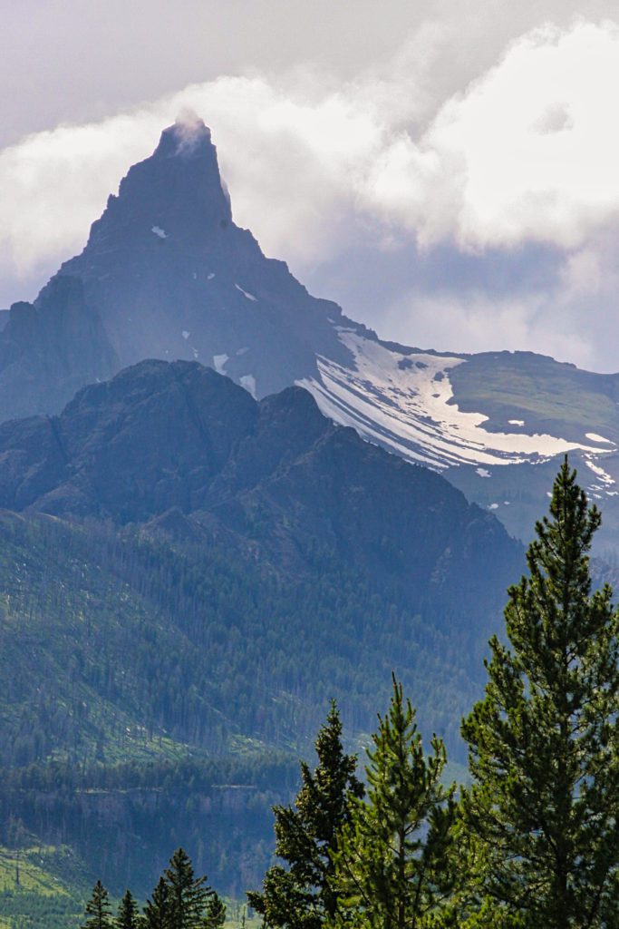
A horn is a sharp peak that is formed by three or more cirques. Therefore, Lone Mountain is classified as a horn, as is Beehive Peak. There are other horns in our region but none as impressive as Pilot Peak located close to Cooke City.
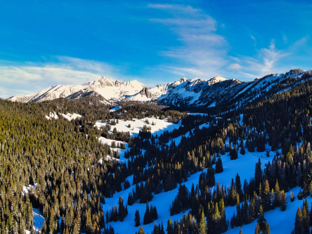
The last landform to be observed is the U-shaped valley. These valleys have steep walls and a relatively flat floor, like a U. Bear Basin, Beehive Basin, Spanish Creek canyon all display these features.
Finally, you should be aware of the active remnants of the last glacial period, the rock glacier. As alpine glaciers retreated 10,000 years ago, they left easily eroded cliff faces around their cirques causing rock falls and rock avalanches to cover the surface of the remaining small glaciers. This rock acts as an insulating layer and is also incorporated into the ice. This ice-rock core still exists today and continues to move down the glacial valleys and cirques. On Lone Mountain itself there are at least eight different rock glaciers. They can be identified by their lobate toes and hummocky topography (throw back!). They are found in all the cirques identified earlier, and also Big Rock Tongue, Chicken-head Bowl, Upper Sunlight, Nebraska, and lower Dakota Bowl.
As you get out this season, look for the telltale signs of hundreds of feet of ice in the bowl, the glacially carved topography of the Spanish Peaks, and the active rock glaciers still moving down the mountain.
Paul Swenson has been living in and around the Big Sky area since 1966. He is a retired science teacher, fishing guide, Yellowstone guide and naturalist. Also an artist and photographer, Swenson focuses on the intricacies found in nature.