By Paul Swenson EBS COLUMNIST

Like the rock record I have presented in the last few articles, our region has many layers to its geologic history. I would like to build upon what you have read so far, continuing the ongoing saga of the Big Sky area. It’s a long and complex story and sometimes gets a little heated.
Sitting in the minus 35-degree cold last week I needed to think of something warm, and there is nothing warmer than volcanism. Magma comes to the surface of the Earth at 2,000 degrees Fahrenheit, where it becomes lava once it reaches the surface. There are several types of magma depending on its source: Fluid, basaltic magma if it passes through thin oceanic crust, like Hawaii; or thick, explosive, andesitic magma if it passes through continental crust, like the Cascade or Andes mountain ranges.

The Gallatin-Absaroka volcanic field is an immense collection of volcanic rocks that stretches 200 miles from Hyalite Canyon just south of Bozeman, to Dubois, Wyoming, and averages about 60 miles across. Depending on where you measure the thickness of this formation, it can be 2,000 feet to 5,000 feet thick.
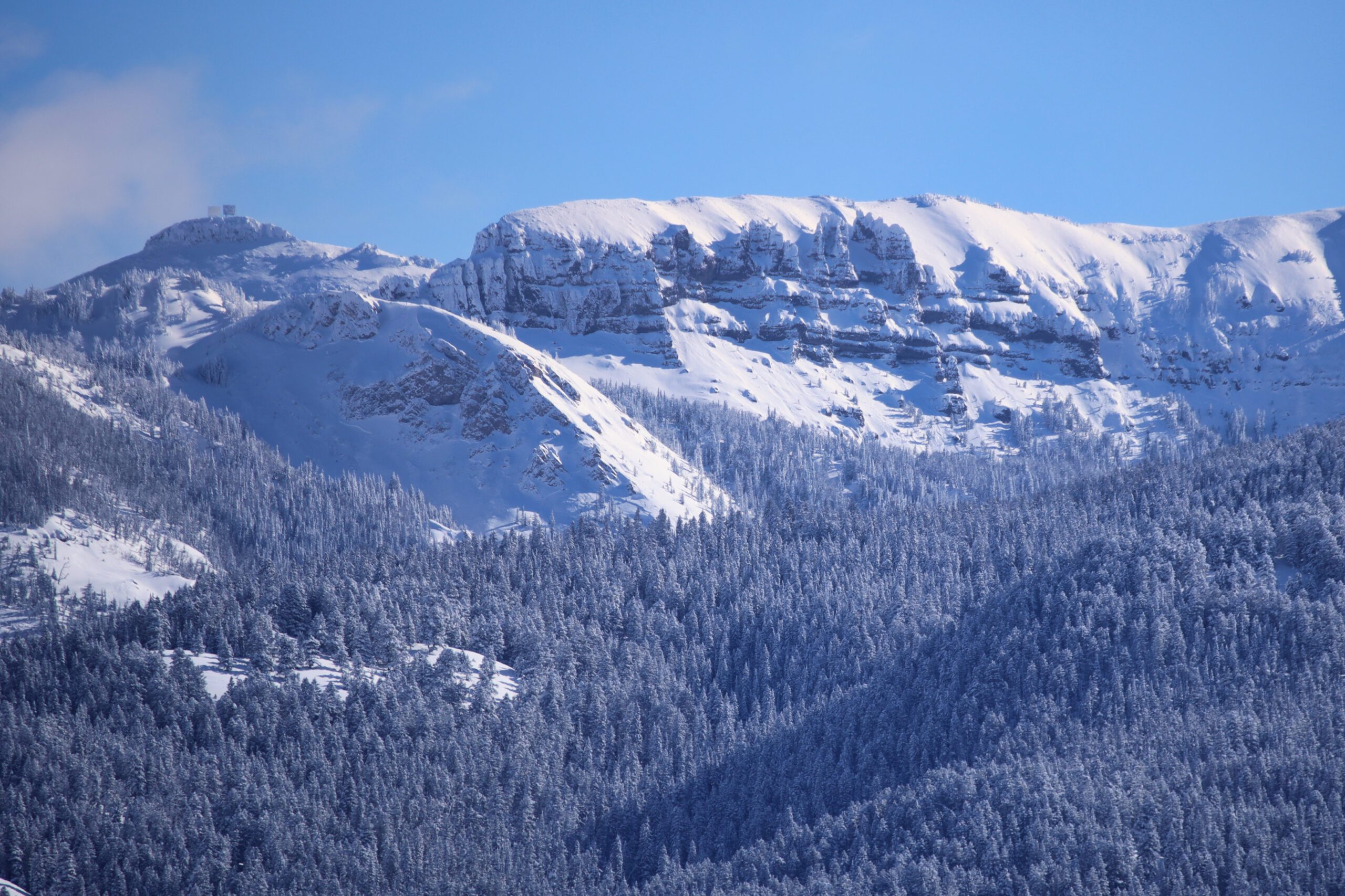
The age of this volcanism is between 53 and 43 million ago. This date coincides with the end of the uplift of the Rocky Mountains. Therefore, these volcanic rocks were emplaced on land surface high above sea level. It is not surprising then that many of our highest peaks along the Gallatin Crest Trail, through Yellowstone National Park, then down into the Absaroka range in Wyoming are composed of these volcanic rocks. Here are a few of our local peaks that are a result of this volcanism: Blackmore, Hyalite, Fridley, the Sentinel, Fortress, Ramshorn, Washburn, and the list keeps going. Between here and Dubois, there are 130 named 10,000-foot-plus peaks in this volcanic field. Of course the rocks of these mountains have been shaped by water, ice, wind and time.
Another fascinating aspect of this formation is when one observes the locations of the volcanoes or other vent complexes that brought the magma to the surface. Over the 200-mile length there are 12 identified major vents: Point of Rocks, Emigrant Peak, Electric Peak (YNP), and others. Their distribution and rock types are very similar to the Cascade Range of Washington and Oregon. Imagine standing here 50 million years ago, looking towards Gardiner. We would see volcanoes that looked like Mt. Hood, St. Helens, Baker, or Rainer. And just like the Cascade volcanoes, our local ones would have similar type explosive eruptions—think Mount St. Helens.
During the 1980 eruption of Mount St. Helens, there was a huge landslide that started the major eruption, but another more far-reaching event also occurred. During the initial phase, the snow and glaciers on the mountain melted sending torrential floods down the mountain sides mixing with volcanic ash and rocks causing very large mud and debris flow called a lahar. In the Toutle River Valley below the volcano, 3 billion cubic yards of mud and debris were deposited along the first 20 mile stretch. Thousands of trees were inundated by this lahar.
So how does this influence us locally? The thousands of feet of rocks at the headwaters of most of the drainages east of U.S. Highway 191 consist of layers upon layers of lahars, and contained within them are trees, 50-million-year-old trees. They were buried in the hot mud and rock of lahars that killed all the bacteria and fungi that would normally decompose the wood. Instead, the silica rich ground water surrounded and permeated the wood of the trees replacing the organic material of the cells of the tree with silica. These trees became rock, petrified wood.
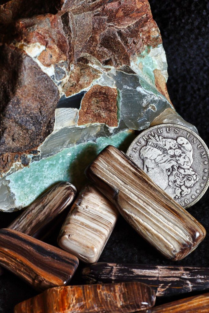
This happened time and time again. In the Gallatin Petrified Forest up Tom Miner Basin, there are 27 different levels of petrified trees, some of which are still preserved upright. Paleologists have identified many different species of trees that lived here including sequoia, redwoods, magnolia, ferns, pine, elm, willows, and others. Hiking along Windy Pass, Fortress, Ramshorn, or Specimen Ridge, one will see these trees in the rock faces. Please do not disturb any of the petrified trees where they are found in these layers.
Petrified wood is fairly hard, so one can find pieces that have been eroded and washed down into the gravel bars of the Gallatin and Yellowstone rivers. They are fun little treasures to find, especially when the fishing is slow. They are beautiful and you can still see the growth rings, the grain, and if you’re lucky, there might be small pockets of agate. It’s cold, but thinking about splashing about in the river next summer will get us through it.
Paul Swenson has been living in and around the Big Sky area since 1966. He is a retired science teacher, fishing guide, Yellowstone guide and naturalist. Also an artist and photographer, Swenson focuses on the intricacies found in nature.