
By Paul Swenson EBS COLUMNIST

As you have probably surmised after reading the last several columns, I am kind of a rock head. Not kind of, but really. I grew up a rockhound, collecting fossils and petrified wood, agates, panning for gold, and whatever piqued my interest at the time. I went to school and studied geology and geophysics, which added a layer of understanding to the landscape that I enjoy sharing with you.
One field of geology is called geomorphology: geo-earth, morph-shape, ology-study. So quite literally, the study of the shape of the landscape and the causes that formed it. My former students from Lone Peak High School will recognize this term from geomorphology: Hummocky Topography. It’s fun to say, and easy to recognize once you learn what to look for.

The word “hummock” has its origins in the British Isles sometime in the mid 1500s. It was a word used by sailors to describe small, conical, sand hills along the shoreline. The word is now used to indicate a small hill less that 45 feet tall, sometimes referred to as a “hillock.” So if one finds a collection of these small hills arranged randomly across the countryside, the term hummocky topography is used.
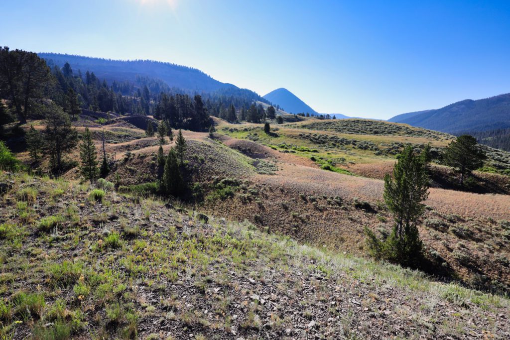
There are many places one can find hummocky topography in the Big Sky region, and all are caused by one of two processes: glacial deposits or landslide debris.
As glaciers advance and retreat, they leave the solid material they erode behind in deposits called glacial moraines. This material can be seen spread around all over Big Sky, especially in Beehive Basin, Middle Basin, Bear Basin, and the bowl on Lone Mountain. If the material at the terminus of these glaciers has not been reworked by streams, you will find hummocky topography.
Driving the last half mile to the Beehive Basin trailhead, the road cuts through a terminal moraine and the landscape is full of hummocks and the undrained depressions between them which form marshy areas.
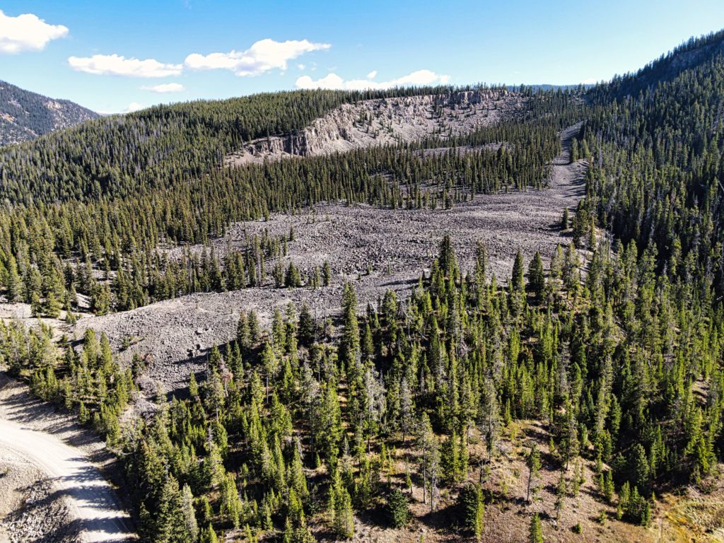
The other major cause in our area are landslides. Landslides are usually caused by a combination of weak rock layers, overly steepened slopes, water, and some type of seismic event. The geology of our region has all these ingredients. In the last two columns you read about the Thermopolis Shale (the weak rock) and the Huckleberry Ridge Tuff (a cap rock which causes overly steepened shale slopes). Add to that some water from several years of wet winters and summers and a tremor from an earthquake, and landslides can be a result.

Landslides have features that stand out when you look at them: crown, scarp, body, and toe. The crown is the very top of the slide, the scarp is the steep hillside or cliff where the material has moved away from the crown, the main body is all the material that moved, and the toe is the terminus of the slide where is has flowed out onto a valley floor or plane.
It is the material of the main body that loses its structure during the slide’s motion and displays the random hummocky topography associated with a landslide. One such slide can be identified at the “Hummocks” trail system. The crown is the ridge top along Skywood to Mitchner Road, the scarp is the cliff of Huckleberry Ridge tuff, and the main body is what one hikes along on the trails with its undulating surface and marshes and ponds.
Another great example is the “Blowout” along Taylor Fork. The road had to be constructed up and over the toe and body of a large slide that came from the south and ran across the valley floor. How long ago is unknown, but there is a large fault line that extends from Ennis to Reynold’s Pass to the south that had a major event about a thousand years ago, so that would be my bet.
And finally, the best slide around, Earthquake Lake slide. If you have not been to visit this spectacle of nature, it’s an hour drive from Big Sky along the Madison River below Hebgen Lake. In 1959, a 7.3 magnitude earthquake struck the region from the Yellowstone National Park boundary west to the Madison Valley some twenty miles away. The mountain that fell into the river that night to form Earthquake Lake had been over steepened by erosion from the river. The slide claimed 28 lives and they’re memorialized on a plaque at the visitor center.
Hopefully you’ll look at our region with a new level of understanding and some new vocabulary that’s fun to say and fun to see.