By Ciara Wolfe EBS CONTRIBUTOR
Ralph’s Pass, a 2.7-mile intermediate pathway connecting the popular Big Sky trails of Ousel Falls and Uplands, provides an enjoyable experience for all. Quality trail construction and design enhance any hike, bike ride or run through the diverse scenery along the trail. Ralph’s Pass opened in June 2017 after the Big Sky Community Organization worked for three years to secure easements from 10 private landowners and garnered funding from multiple sources.
I started my Ralph’s Pass hike at the Ousel Falls Trailhead. I headed down the Ousel Falls Trail for one-third of a mile and then took a left. From there, I followed the South Fork of the West Fork of the Gallatin River through a heavily forested area. Please leash your dog after passing through the gates onto private property. After passing through the gates, you’ll travel across some of the longest boardwalks in Big Sky, crossing wetlands and climbing up several switchbacks until reaching a gravel road that serves as a private driveway.

After crossing the road, the trail will climb a little more and continue through a wooded area with views of a meadow below and the steep cliffs carved by the South Fork. After a short descent you’ll come to another road crossing.
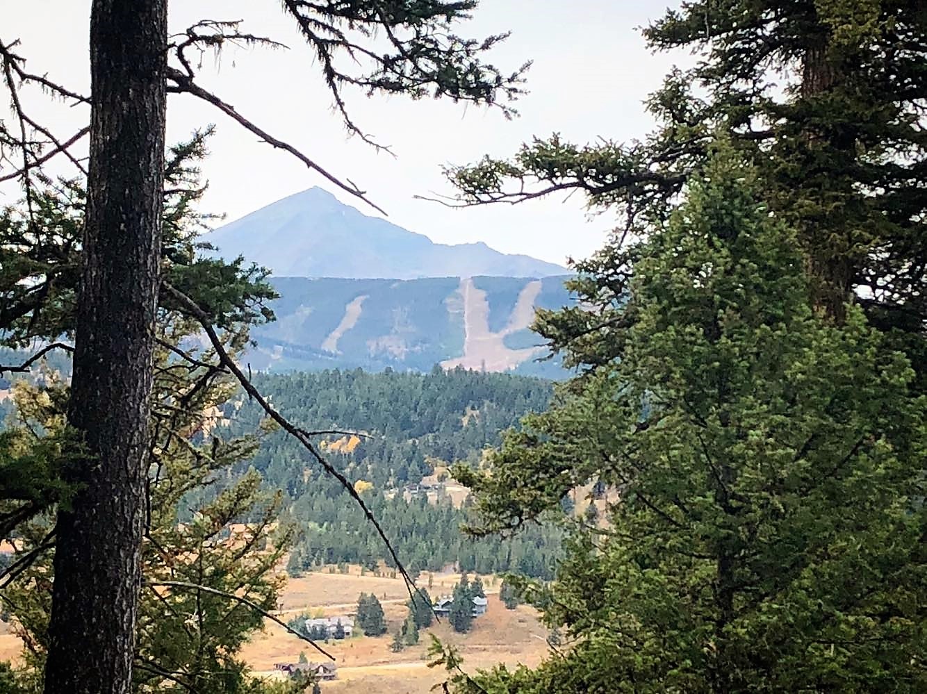
In the remaining mile of this trail, you’ll meander through several small meadows and climb approximately 800 feet on three series of switchbacks. The switchbacks are designed to be user-friendly with wide corners and berms. Be sure to stop and enjoy the scenery on the last series of switchbacks: Lone Mountain, Pioneer Mountain and Beehive Basin are all visible from this part of the trail.
At the end of this climb, you’ll reach a beautiful mountain meadow with abundant wildflowers and signs of wildlife. The end of Ralph’s Pass is marked by a gate located at the top of the Uplands Trail. Follow Uplands for a 1-mile descent to the Hummocks and Uplands trailhead.
Start from the Ousel Falls Trailhead for a consistent 2.7-mile climb to Uplands followed by a steep 1-mile descent to the Uplands Trailhead. I would recommend that trail runners and bikers traveling one way start at Uplands Trailhead for a quick climb and gradual descent on Ralph’s Pass. You can also connect the two trailheads on Aspen Leaf Drive using the Ousel Falls Road Trail to create a 7-mile loop on the community trail system from Town Center.
Please note that the trail is open from June 15 to Oc.t 15 each year, so get out there this weekend to enjoy the fall colors before it closes to protect sensitive wildlife habitat.
Visit bscomt.org for more information about Big Sky’s parks, trails and recreation programs.
Ciara Wolfe is the executive director for the Big Sky Community Organization.
A version of this story first appeared in the Oct. 12, 2018, edition of EBS.
Trails Stats
Distance: 4 miles one-way from Ousel Falls Trailhead to Uplands Trailhead
Difficulty: Moderate
Elevation: 6,540 feet at Ousel Falls Trailhead and 6,285 feet at Uplands Trailhead
Surface: Dirt
Uses: Hike, bike, run
Restrictions: Dogs must be on leash; open June 15-Oct. 15.
Directions: The Ousel Falls Trailhead is located 2 miles south of Lone Mountain Trail off of Ousel Falls Road. The Uplands Trailhead is located near Town Center. Head east on Aspen Leaf Drive, cross a bridge over the river and continue up the road until you see the parking area and Uplands Trailhead on the left.