A lookback at the Yellowstone Ice Cap
By Jessianne Castle EBS ENVIRONMENTAL & OUTDOORS EDITOR
GARDINER – Ken Pierce pulled his hat low as a katabatic wind swept fiercely down the valley. The retired geologist moved briskly, despite walking head-on into the October gale. After collecting himself at the top of a small rise, he stopped and cast his eyes to the ground.
We were standing upon an overwhelmingly barren slope, and the surface of the land was punctuated by a series of ripples as the hill descended toward the road. Amid non-native cheatgrass and sparse clumpings of rabbitbrush, large rocks protruded from the soil in long, narrow rows.

The rocks were deposited by water some 15,000 years ago as a series of glacial floodwaters 200-feet deep poured from Lamar Valley out into the Yellowstone River drainage. The volume and force of the water had its way with the land, and much like the ocean tide creates a kind of washboard in sand on a beach, the glacial water formed a series of megaripples roughly 60 feet apart.
“This is an amazing geologic feature. I call this a geewizz stop,” Pierce said. He spoke from years of research, explaining the process of glaciation in the Yellowstone range.
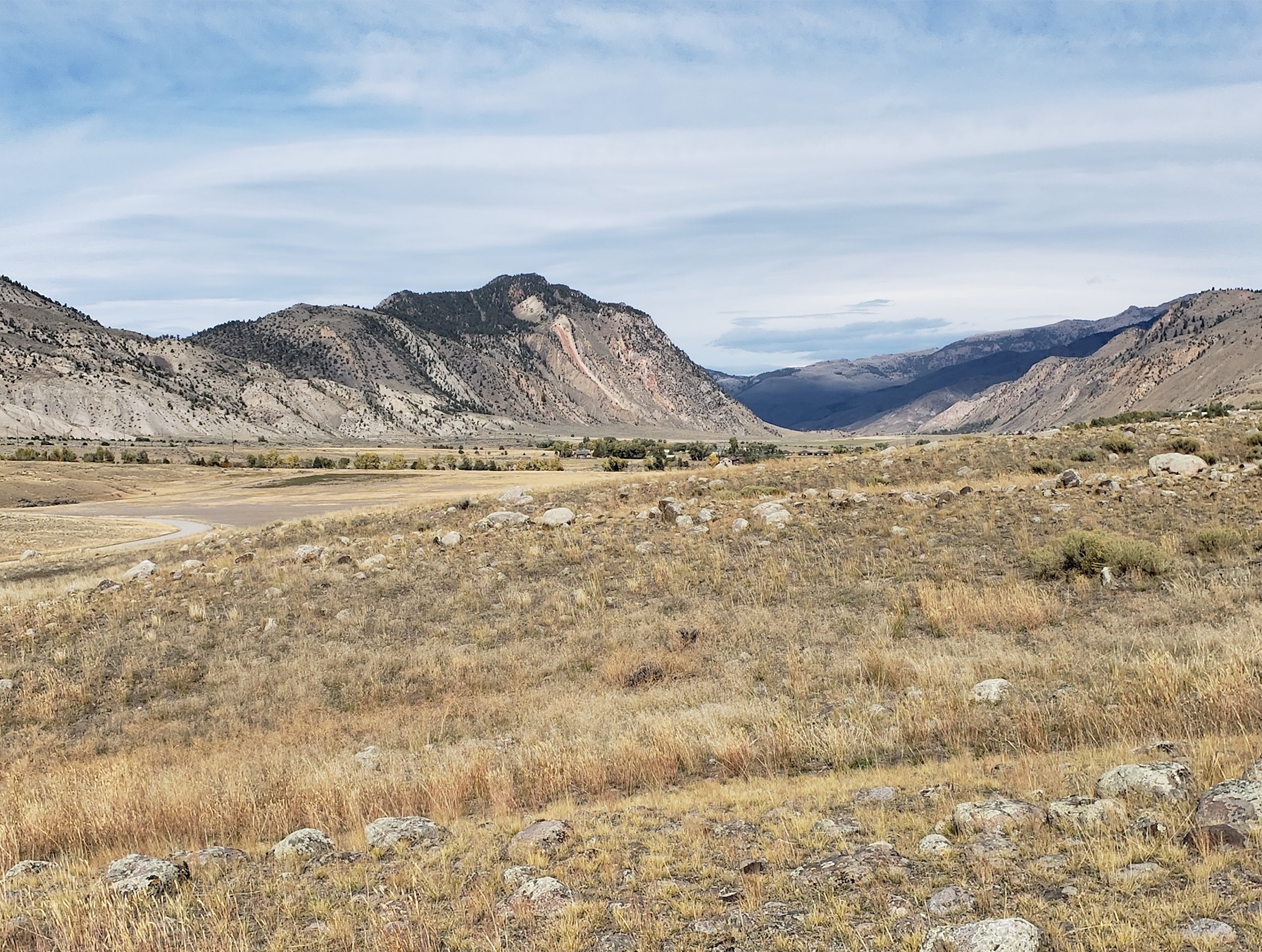
We were just south of Gardiner, and with Sepulcher Mountain gazing sternly upon us, we climbed from our bus parked on the side of Old Yellowstone Trail, a dirt road that meanders through a strip of Yellowstone National Park. Pierce, who retired in 2003 but continues to work as a geologist emeritus with the United States Geological Survey’s Northern Rocky Mountain Science Center, was leading a class of about 20 as a part of the Montana State University Alumni Association’s Wonderlust Lifelong Learning continued education program.
Entitled “Ice Age Yellowstone,” the day-long course was an immersive look at the remains of an ancient glacier that once capped a large swath of the Greater Yellowstone region.
In Gardiner, before floodwaters rushed over the land, an estimated 3,000 feet of ice claimed the drainage. Only the very top of Sepulcher Mountain in the Gallatin Range to the west and a select few pinnacles in the Beartooths to the east were free of the ice cap’s hold.
Researchers believe Yellowstone has experienced a number of glacial periods over the last 2.6 million years, with the last major glaciation occurring about 20,000 years ago. Known as the Pinedale Glaciation, ice and water poured from the Washburn Range, Beartooth Plateau and over the Gallatins, ultimately forming today’s landscape around the North Entrance of the park, as well as Paradise Valley.
Indeed, the unique landscape known for its thermal hot springs and geysers—not to mention, one that hosts four million visitors each year—is as much thermal as it is glacial.
Yellowstone’s high-elevation volcanic plateau was an ideal site of glaciation as snow readily accumulated across the region, and the park’s glaciers formed over an extended period of time as more snow fell than melted. As the snow built up, it turned to an ice cap over a large extent of Yellowstone National Park. Along its edges, the ice began to slowly move under the force of gravity and from its own weight, forming glaciers that picked up rocks, eroded the earth in some places and deposited sediment in others.
As the climate warmed and the earth transitioned into what is known today as the Holocene geological epoch, the northern outlet glacier in Paradise Valley began to recede south, leaving behind wide swaths of fine-grain sedimentation known as outwash plains, and accumulations of rock and mixed sediment that formed hill-like moraines.
From the pull off at Mallard’s Rest Campground 14 miles south of Livingston, we observed the remains of Pinedale’s first recession. Highway 89 juts south from Livingston across the glacier’s outwash plains, dramatically visible at Mallard’s Rest. With cars on the highway whizzing past, one need only look west, down off the 150-foot cut bank and into the Yellowstone River.
“We’re quite a bit above the Yellowstone River,” Pierce said, gesturing to the cut bank and river below. “The reason that the outwash is so thick here is that the weight of the ice cap pushed the crust of the earth down. Normally in Rocky Mountain glaciers, the outwash is about 30 feet thick.”
As the ice melted, the resulting water slowly established a route down Paradise Valley, and huge volumes of water eroded the outwash sediment, forming what we see today as a large cut bank.
The historic Chico Hot Springs are nestled within the remains of a second recession period for the glacier, as the irregular, hilly landscape, characterized by mismatched smooth and angled rocks of various sizes marks the location of the Chico moraines, where the edge of the glacial ice sat for a period of time.
Over the course of several thousand years, the Yellowstone glacier slowly diminished in size and melted ice accumulated as a lake within Lamar Valley, dammed by gigantic chunks of ice. But once enough water collected to float the ice, the lake waters were released, and a deluge swept into the Yellowstone drainage.
With ice melted and amid a warming climate, the landscape transitioned from a barren tundra to a semi-forested complex of lodgepole and Douglas fir parklands that have evolved into today’s dense forests and hot and dry sagebrush desert steppe.