
Summer thunderstorms normal but indicate changing patterns, weather experts say
By Jessianne Castle EBS ENVIRONMENT & OUTDOORS EDITOR
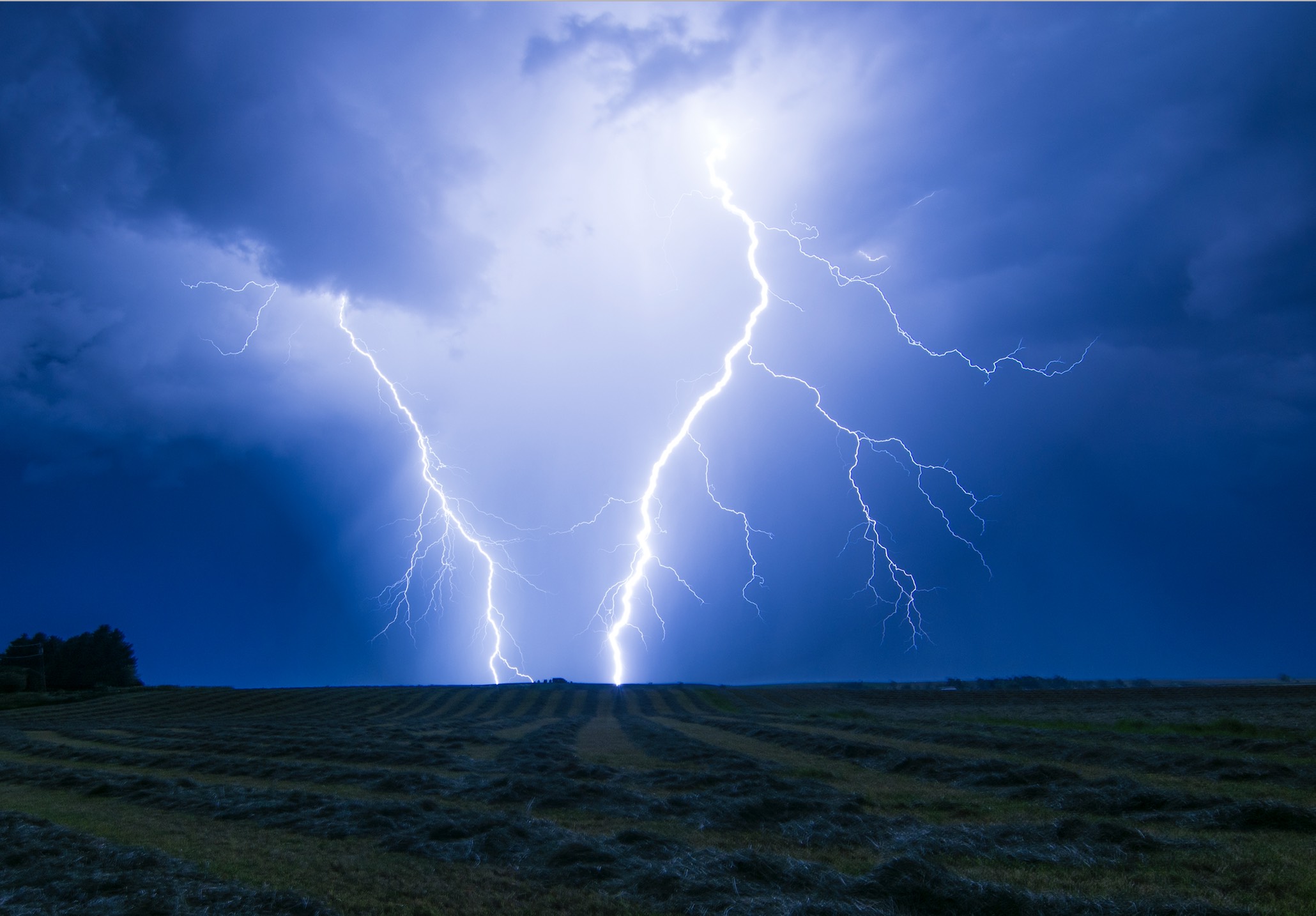
BIG SKY – Appearing billowy and soft in the sky, cumulous clouds churn together forming a dark anvil-shaped mass that blots out the summer sun. They drift ominous over Lone Mountain before unleashing a force of thunder, lightning, pounding rain and hail.
It’s not unusual for thunderstorms to crack open summer skies in the mountains, but the omnipresent afternoon squalls this July across a large portion of southwest Montana have done more than spark a handful of wildfires—they’ve also got many wondering if 2019 is turning out to be an unusually wet year.

While a severe thunderstorm can evoke those feelings of awe and terror in the moment of the storm, weather experts say this year’s storms are fairly typical of the overall climate in Montana.
According to National Weather Service meteorologist Joe Lester, who is based in Billings, our thunderstorm intensity is pretty normal, and while it’s been a wet year, precipitation hasn’t been off the charts. The Gallatin River Basin, according to the Montana Snow Survey Program, received 109 percent of the normal precipitation in July. This amounts to fractions of an inch of more rain.
“I don’t think it’s been anything too out of the ordinary,” he said, however he added there’s been a change in our weather pattern: As compared with the past few years, the thunderstorm season seems to be happening later in the summer, meaning we’re likely to see that hot, dry weather southwest Montanans are accustomed to later in August.
The reason for the delayed rain clouds? Lester describes the immediate reason as having to do with the actual mechanism of a thunderstorm. A wet spring keeps humidity up, allowing instability to build within the clouds, thus maintaining an almost daily thunderstorm potential.
There are three ingredients required to make a thunderstorm: moisture, unstable air and lift.
As the sun heats air near the ground, cold air blown in over the mountains causes the warm air—which weighs less than the colder air—to lift. As this air rises rapidly, it creates turbulence and transfers heat from the earth surface to the upper levels of the atmosphere. This produces a buildup of water vapor that forms a cloud and as the outside air cools, water and ice develop.
The turbulence creates an electrical charge in the storm cloud in the same way as rubbing your feet on carpet. As the cloud becomes negatively charged, it is attracted to a positive charge on the ground and the electrical current is discharged, resulting in lightning and thunder. Lightning, coursing at 50,000 degrees, Lester says, heats the air causing a shockwave that produces the crack of thunder.
A severe storm, classified as one that produces 1-inch hail, at least 58-mile-per-hour winds or a tornado, develops from wind shear, or when wind changes in direction, speed and height. According to the National Severe Storms Laboratory, there are about 100,000 thunderstorms each year in the U.S. and about 10 percent of these reach severe levels.
While Lester described the immediate reason for our thunderstorms, the cause for our wet spring that is maintaining humidity and storm potential could have to do with climate change.
Montana State University earth sciences professor Cathy Whitlock, the lead author of the Montana Climate Assessment, projects an overall warming trend in the coming decades but also says storm patterns are likely to change.
Whitlock was unavailable for an interview at EBS press time, but in a 2018 interview with EBS she predicted that Big Sky can expect similar precipitation amounts in the future, but snowpack won’t last as long, spring floods are probable and late-summer droughts are likely.
“We’ve seen periods in the past when it’s been warmer than it is today, but we’ve not seen a rate of warming as fast as is happening right now,” Whitlock said. “We can already see the effects in Montana, across the country and around the world. We’re warming at an alarming rate.”
The Montana Climate Assessment—a product of the Montana Institute on Ecosystems—reports annual average temperatures have risen across the state between 1950 and 2015 by about 2 or 3 degrees F, while average winter precipitation in western and central Montana has decreased by 1 inch and spring precipitation in the eastern part of the state has increased by about 2 inches.
As noted in the report, Montana experiences a highly variable climate and day-to-day weather as a result of storm systems and air masses from the Pacific, Arctic and Gulf of Mexico. While incredibly dynamic—recall the old adage “If you don’t like the weather in Montana, wait five minutes,”—Montana’s climate directly impacts the state’s economy, having effects on agriculture and recreation among others.
“I’ve come to realize that climate change is really not a stand-alone issue,” Whitlock said. “It affects all aspects of Montana’s economy and social well-being, and it’s time for some serious discussion and planning.”