By Ciara Wolfe BSCO Executive Director
The South Fork Loop, a 1-mile dirt surfaced trail named after the South Fork of the West Fork of the Gallatin River, is the perfect distance and difficulty to get outside and take a quick walk, run with a friend, or spin on your bicycle.
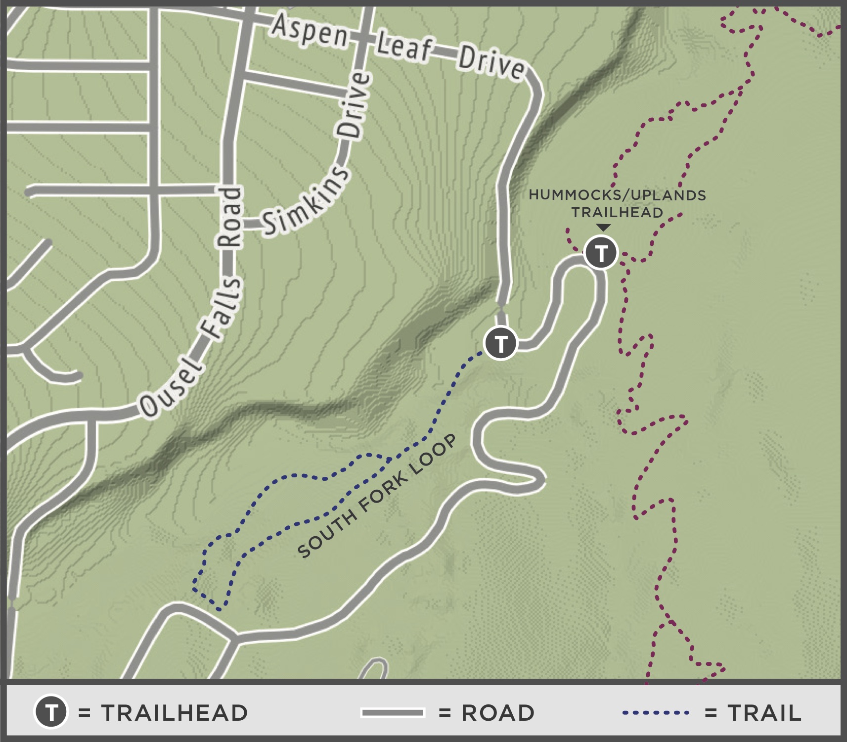
The trail starts out as an old logging road with a wide dirt trail that climbs a gradual hill. About 1/4 of a mile in, you will reach a signed loop junction. I prefer to continue uphill, so I follow the trail straight at the junction. A couple hundred yards beyond the sign, the trail turns into a single track with a gradual downhill. This portion of the trail is entertaining and beautiful, with glimpses of the river and wetland meadow in the distance. At the bottom of the hill you’ll parallel the river before climbing a short distance back to the junction.

Depending on your desired distance, you can loop this trail multiple times. Its proximity to the Hummocks and Uplands trailhead and location less than a mile from Town Center makes this a peaceful loop to extend a longer walk, run or bike. The gradual terrain with a varied width is an excellent beginner’s playground for aspiring mountain bikers, and the river access amidst the forest will make this one of your hound’s favorite spots in Big Sky. Deer, moose and elk also enjoy this area; the dirt trail often provides excellent animal track sightings.
This trail is groomed in the winter and is an excellent addition to BSCO’s Nordic skiing trail system. Don’t let its nearness to town fool you though—bear sightings have been reported, so be bear aware when recreating on the South Fork Loop Trail.
For more information about Big Sky’s parks, trails and recreation programs, visit bscomt.org. The Big Sky Community Organization is a local nonprofit that connects people to recreational opportunities by acquiring, promoting and preserving sustainable places and programs for all.
Trail stats
Distance: 1-mile loop
Difficulty: easy
Elevation gain: 150 ft
Surface: dirt
Uses: hike, trail run, bike and cross-country ski
Directions: From Town Center, head east on Aspen Leaf Drive for ¾ of a mile. You will see a small parking area with trailhead on the right-hand side of the road immediately after a bridge. If the two-car parking area is full, park in the vehicle pullout on the north side of the bridge.