By Ciara Wolfe BSCO Executive Director
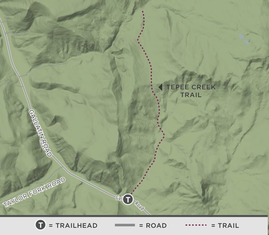
Tepee Creek Trail (U.S. Forest Service Trail #100) begins just outside the northwest corner of Yellowstone National Park and is an excellent hike for those searching for solitude, vistas and wildflowers without strenuous activity.
Given the recent smoky conditions and compromised air quality, this hike is a great option close to Big Sky that allows you to get out on the trail without pushing your heart rate and lung capacity too hard.

From the trailhead, the path begins a gradual incline through a large grassy valley. With one side of the valley located in Yellowstone National Park and the other in Custer Gallatin National Forest this hike provides wildlife viewing opportunities and beautiful vistas without too much elevation gain. The trail meanders through the valley with only a couple access points to small Tepee Creek within the drainage. The trail begins flat with three different sections that have a low grade climb.
Once you have reached the top of the trail along a grassy ridgeline, you will find yourself at an intersection that marks the boundary of the park. From here, you can continue on a much longer and difficult hike or return to the trailhead.
If you choose to continue, you can take Buffalo Horn Creek Trail for another 2.5 miles or all the way back to the Gallatin River for 3 additional miles. In the other direction, the Wilson Drive Trail reaches the top of a peak before entering Yellowstone. From this peak you can see expansive vistas of both the Madison and Gallatin mountain ranges.
Due to the close proximity to the park, please be bear aware and respect the restriction for foot traffic only from April 1 through June 15.
For more information about Big Sky’s parks, trails and recreation programs, visit bscomt.org. The Big Sky Community Organization is a local nonprofit that connects people to recreational opportunities by acquiring, promoting and preserving sustainable places and programs for all.
Trail stats
Distance: 4.6-mile out-and-back
Difficulty: easy
Elevation: 5,525 feet at trailhead
Elevation gain: 700 feet
Surface: dirt
Uses: April 1-June 15: hiking only, June 16-March 30: hiking, horses, and bikes
Directions: Drive south from Big Sky on Highway 191. The trailhead is located approximately 25 miles south of Big Sky on the east side of the highway before entering Yellowstone National Park.